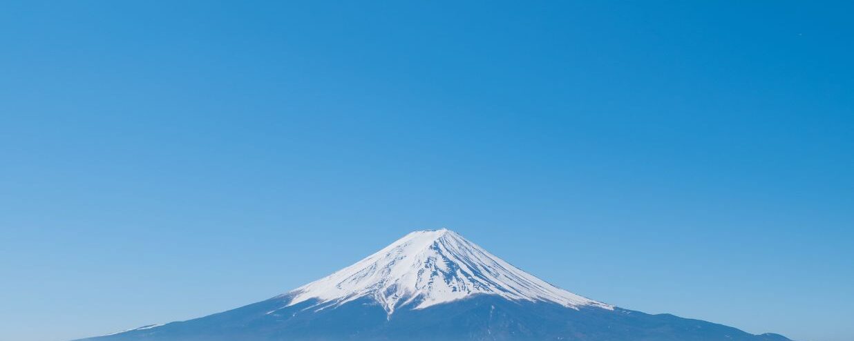
Whether you’re a seasoned climber or a nature lover, hiking in Japan will be a memorable experience for you. Japan is known for its beautiful mountain ranges and nature, hence it has become more and more famous among mountain climbers. The most well-known destination is unarguably Mt. Fuji, as it is the highest mountain and the symbol of the country. However, there are many more incredible hiking and climbing routes in Japan that you can try as well.
From rugged coastal paths to alpine landscapes, here are 10 incredible hiking destinations that every adventurer should consider beyond Mt. Fuji.
1. Mt. Takao
(Tokyo, easy level, 3-4 hours)
If you don’t want to go far, Mt. Takao is probably the closest mountain, as it is still located in Tokyo and takes less than an hour to get there from Shinjuku. Mount Takao consists of many trails (as well as a cable car), so you can pick different routes that suit your hiking style.
The most common one is trail number 1 as it takes you up to the summit while passing many interesting spots such as the observation deck, monkey park, and Yakuo-in temple.
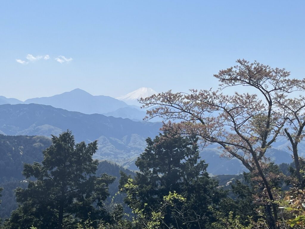
The other routes are less popular and narrower, however, you can enjoy the beautiful scenery and nature at a quieter pace. Moreover, you can also see Mt. Fuji on a clear day.
How to get there: You can take the Keio Line from Shinjuku Station to Takaosanguchi Station, which takes around 1 hour.
2. Magome: Tsumago Trail
(Gifu-Nagano, easy level, 2-3 hours)
During the Edo period, Nakasendo was one of the roads that were constructed to connect Kyoto and Edo (present-day Tokyo) together.
There are only a few sections left nowadays; however, the Magome-Tsumago trail is still well maintained and it’s popular among hikers who are interested in Japanese culture.
The trail is relatively easy and goes through forest and small juku (rest stops) where you can see traditional houses, enjoy tea and embrace the rural lifestyle.
How to get there: You can take a train from Kyoto (90 mins) or Nagoya (75 mins) station to Nakatsugawa station and take a bus from there to Magome (35 mins). You can also take a bus directly from Tokyo (5 hours) or Nagoya to Magome (80 mins) as well.
Another option is to take a train from Tokyo (3 hours) to Nagiso station and take a bus from there to Tsumago (10 mins). There are also buses between Magome and Tsumago (30 mins).
3. Mt. Yoshino
(Nara, easy level, 4-5 hours)
This mountain has been one of the most famous spots for sakura viewing for centuries, and it is covered with more than 30,000 cherry blossom trees. The mountain is divided into 3 areas — Shimo Senbon (lower), Naka Senbon (middle), and Kami Senbon (upper).
Each is named by the difference in height, so you can see the sakura gradually blooming from the bottom to the top of the mountain during the Sakura season. The hike isn’t very difficult, and you can also visit many shrines, temples, and observatories along the way.
Even though Mt. Yoshino is famous for sakura, you can hike this mountain in other seasons, like Spring to see hydrangeas and Autumn to see 紅葉 (もみじ, momiji), or autumn foliage, as well.
How to get there: You can take a train from Osaka-Abenobashi Station to Yoshino Station. It takes around 75-90 minutes, depending on the type of train you take.
4. Mt. Mitake
(Tokyo, easy-advance level, 1-8 hours depending on the routes)
Located in the Okutama area, Mt. Mitake is a sacred mountain with beautiful views and various hiking routes. You can take a cable car (or even hike) from the station to the small village and the famous Musashi-Mitake shrine.
From here, you should hike down to the Rock Garden, where you will see beautiful waterfalls. Other mountains, such as Mount Hinode or the harder ones such as Mt. Odake and Mt. Nokogiri, are also our recommendations for a bit more experienced climbers.
How to get there: You can take the JR Chuo line from Shinjuku station to Ome station, then change to the Ome line for Okutama and get off at Mitake. It takes around 90 minutes. From there, you can take a bus for around 10 minutes to the cable car area where you can take a ride or start hiking from there.
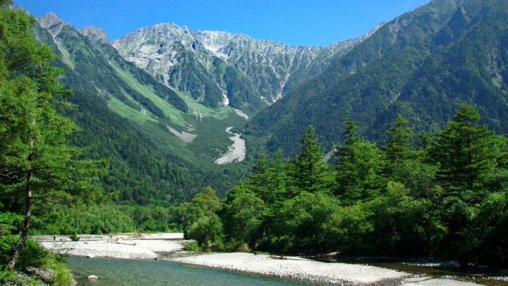
5. Kamikochi
(Nagano, easy-advance level, 2 hours – 2 days depending on the trail)
Kamikochi is known for its beautiful nature, especially for the colorful autumnal foliage. Easily accessed from Matsumoto, if you have only a day, you can walk along the easy trail to enjoy the reflection of mountain ranges in Taisho, Tashiro, and Myojin ponds as well as check out the famous Kappa bridge.
However, beyond the bridge, there is a hiking trail to Tokusawa, Yokoo Sanso, and up to Karasawa Cirque, one of the most famous glacial cirques in Japan.
As part of the Northern Japanese Alps, the cirque is surrounded by many mountain peaks, and it is an ideal place for camping. Besides Karasawa Cirque, there are other trails such as Mt. Hotaka.
How to get there: You can take a train from Matsumoto to Shin-Shimashima station (30 mins) and take a bus to Kamikochi (60 mins). You can also take a bus from Takayama station to Hirayu Onsen (60 mins) and take a bus to Kamikokochi from there (25 mins).
However, there are also direct buses from Matsumoto as well as Tokyo and Shinjuku stations (5-7 hours). Besides getting off at Kamikochi bus stop and going to Kappa bridge directly, you can also get off at Taishoike bus stop to go to Taishi pond and walk around 1 hour to Kappa bridge.
6. Mt. Aso
(Kumamoto, mid-level, 3-7 hours depending on the peaks)
Mt. Aso is the largest active volcano in Japan and consists of 5 peaks — Takadake, Nakadake, Eboshidake, Kijimadake, and Nekodake.
You can drive or take a shuttle bus to see Nakadake Caldera up close. However, if you plan to hike, one of the easiest peaks is Eboshidake, which is a bit far from the crate,r so it usually doesn’t get affected much by the gas.
As the mountain is currently active, you need to check if there are any hiking restrictions on the official website.
How to get there: You can take the famous Aso Boy limited express train to Aso station (80 mins). From there, you can take a bus for 30 minutes to Asosan Nichi station. There are also buses to Nakadake crater. However, if you want to hike Eboshidake, you need to get off at the Aso Volcano Museum (Kusasenri Aso Kazan Hakubutsukan Mae) bus stop.
7. Tateyama Mountain Range
(Toyama, mid-level, 5 hours)
Tateyama is one of the “Three Holy Mountains of Japan” alongside Mt. Fuji and Mt. Haku.
Most people take the Tateyama Kurobe Alpine Route to Murodo and start from there, as you can see the beautiful scenery of the Northern Japanese Alps as well as play with the snow at Yuki no Otani snow wall, which can be up to 20 meters around April to June.
From Murodo, there are several trails, but the most famous peak is Mt. Oyam, which is where the sacred Oyama shrine is located.
How to get there: You can take a cable car from Tateyama station to Bijodaira station for less than 10 minutes, then take a bus there for 50 minutes to Murodo.
8. Oze National Park
(Gunma, easy-mid level, 1-3 days depending on the trails)
The famous national park consists of a gigantic Ozegahara marshland and Ozanuma pond, where you can hike and explore the area on the elevated boardwalks.
The marshland itself is gigantic, and you can spend a whole day in the park. However, Oze also has many mountains within the area, and the most famous one is Mt. Shibutsu, which is considered as one of the “100 Famous Japanese Mountains.”
How to get there: You can take a train to Numata station and then take a bus to Tokura station. From there, you take a bus to Hatomachitoge trailhead, which is near the marshland. However, the bus only operates during the peak season from May to July and September to October. The other option is taking a bus from Tokura to Oshizumi, which is close to the lake.
9. Yakushima Island
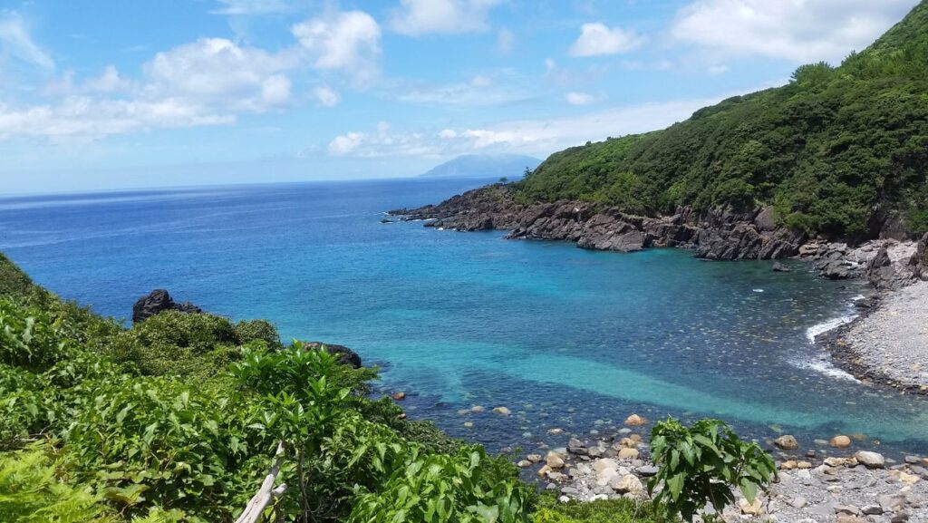
(Kagoshima, easy-mid level, 2-3 days)
You can take a ferry or a plane to visit Yakushima, which is known for its wildlife and nature. There are many trails on the island so you can walk around to explore the villages or hike to see Jomonsugi, the gigantic cedar tree, which is believed to be the oldest tree in Japan.
One of the most famous trails is the one leading to Shiratani Unsuikyo, the famous moss forest, which is said to be an inspiration for Studio Ghibli’s Princess Mononoke. You can also hike up to Mt. Miyanoura, the highest mountain in Kyushu.
How to get there: You can take a high-speed boat (2-3 hours) or a car ferry (4 hours) from Kagoshima to the island. You can also catch a flight from Kagoshima airport to Yakushima airport, which takes around 40 minutes.
10. Kumano Kodo
(Wakayama, easy-advance level, 2-6 days depending on the trails)
Kumano Kodo is an ancient pilgrimage trail dating back to the Heian era, where you can visit 3 sacred shrines collectively known as Kumano Sanzan.
There are several routes to hike; however, the most common one is Nakahechi, as it has the best infrastructure and is the safest among the routes. Besides visiting the famous shrines, you can stop by several onsens, such as Yunomine onsen to relax after a long, multiple days of walking.
How to get there: You can take a JR train from Shin-Osaka station to Kii-Tanabe station, which takes around 2 hours. Then, you can take a bus to Takijiri, which is the starting point of the Nakahechi route.
Want to learn Japanese in Shibuya? Contact us for a free level check!
We here at Coto Academy are opening a new branch right in Shibuya! If exploring Shibuya sounds like a good plan, why not practice your Japanese while you’re at it? You can learn more about our convenient new location here
FAQ
What is the best time to hike in Japan?
Even though it’s very hot in summer, the weather becomes colder the higher you hike. Moreover, most of the huts fully open around July and August, so it’s more convenient to hike around this time. However, some mountains are famous for cherry blossoms in spring and foliage in autumn. It’s not recommended to hike in winter as many trails are closed.
What do you wear when hiking in Japan?
You need basic hiking clothes that are easy to move in, made of breathable materials. The weather can change easily in the mountains, so you should also bring a lightweight sweater, parka, or down jacket if you hike in spring or autumn. Everything should be water-resistant or water repellent to avoid getting wet. Moreover, you might also need sun and insect protection in summer.
How do I prepare for hiking in Japan?
Besides proper clothes and shoes, you should also bring water, some snacks, and a map. Most Japanese hikers also tie bear bells to their bags to make some noise and scare away wild animals. Even though it’s not compulsory, some hikes might require you to leave your name and contact information for safety reasons.